 Nature & Outdoor
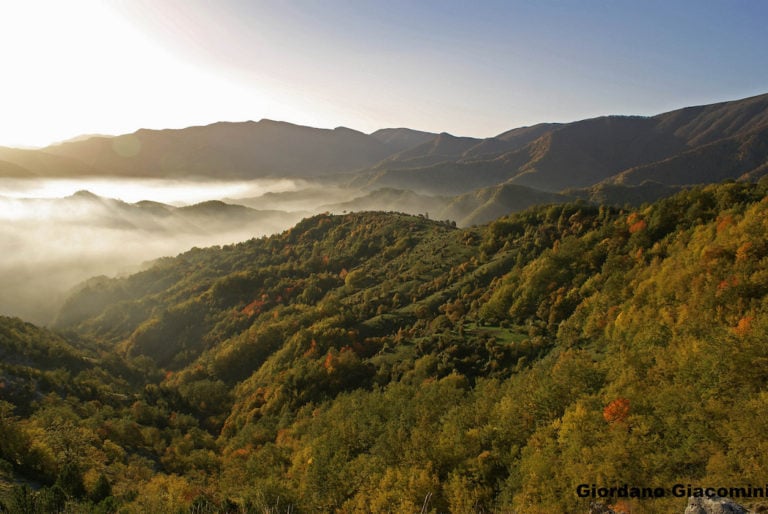
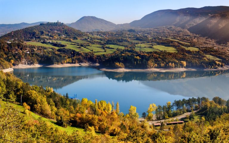
Panoramic ridges, millenary forests, ancient mule tracks: the Casentinesi Forest Park never ceases to amaze its guests. Yes, because surrounded by such an ancient beauty we can only feel guests of the place we’re visiting, getting around respectfully among its natural treasures.
For this reason, we want to recommend you some itineraries to visit the Casentinesi Forest Park in an ideal way, on foot: slowly, with deference to the place and curiosity to discover its history and hidden gems.
Nature Trail in Acquacheta
Difficulty: 2 out of 5 boots
Total length: about 9 km
Difference in altitude: 250 m
Average walking time: 4,30 hours
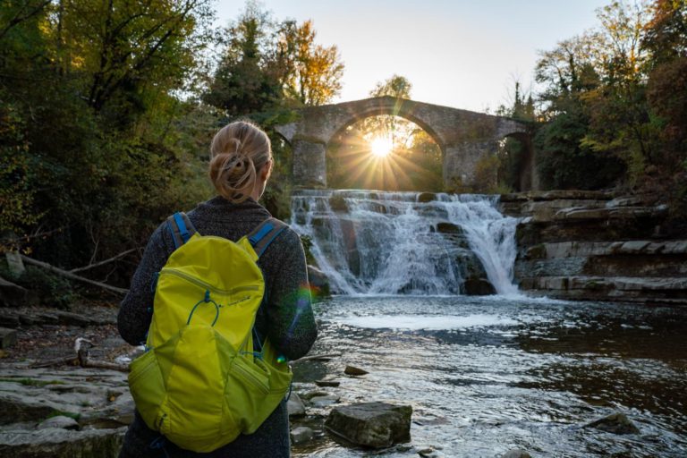
This Nature Trail suitable for the whole family takes its name from the scenic Acquacheta Waterfall, also famous for being mentioned by Dante in his Comedy.
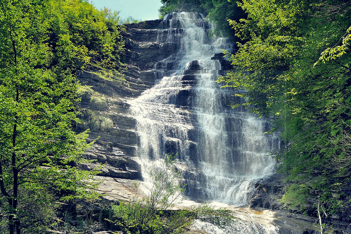
But this waterfall is not the only interesting place to discover along the way: the path leads to the Piana dei Romiti, a prairie dotted with trees and shrubs, with the Acquacheta stream flowing in very slow meanders.
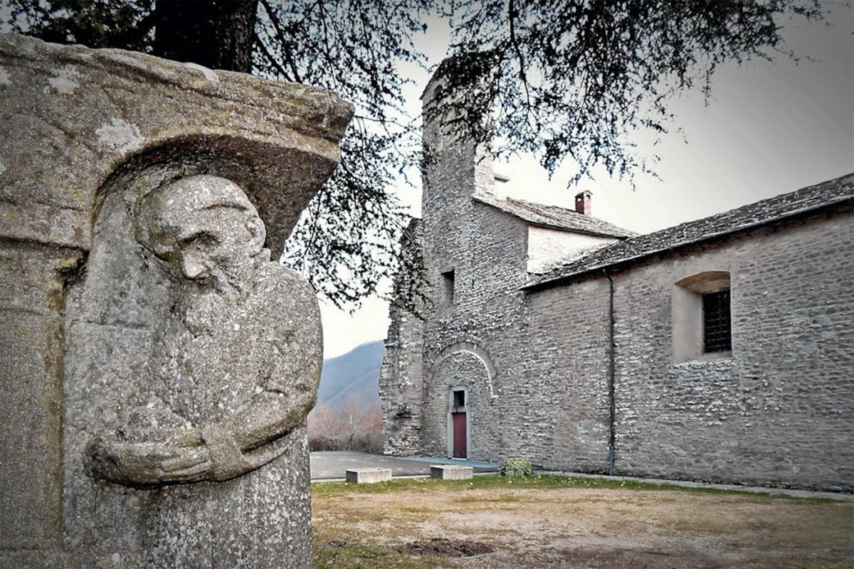
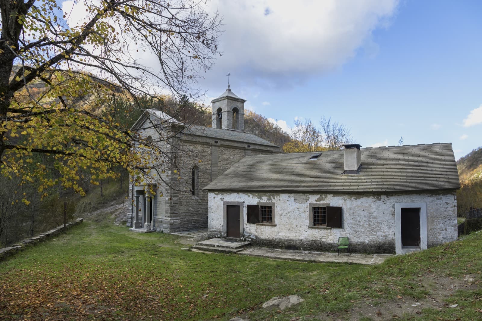
On a rocky spur above the waterfall stands the Villaggio dei Romiti, of which only a few ruins remain, but where once stood the hermitage of the Abbey of San Benedetto in Alpe, founded in 986 by the monk San Romualdo: a high spirituality-rate place immersed in the nature of the park.
Discover the other Nature Trails of the Park
San Paolo in Alpe: a plateau between earth and sky
Difficulty: 3 out of 5 boots
Total length: 6.3 km
Difference in altitude: 400 m
Average walking time: 3,30 hours
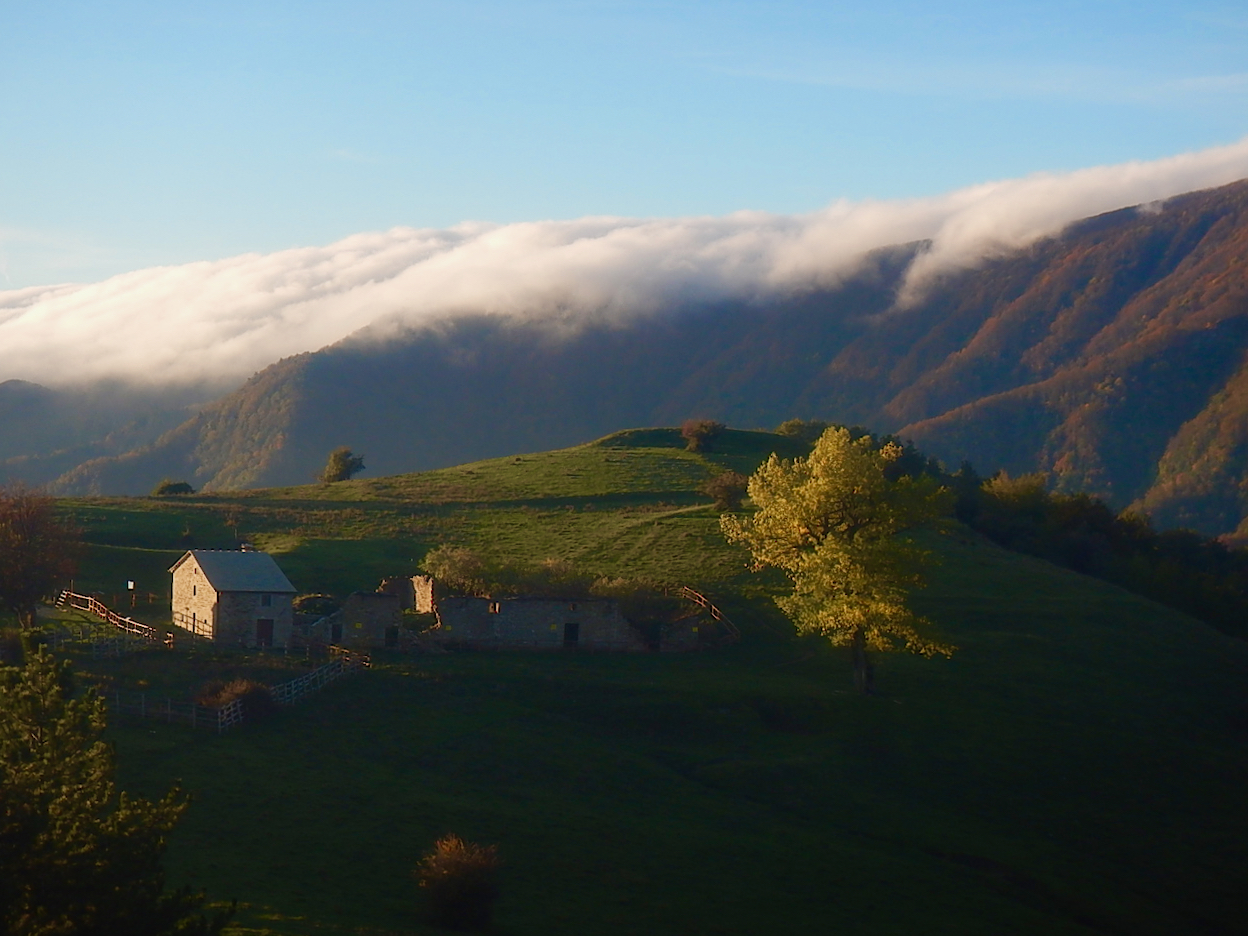
The San Paolo in Alpe: a plateau between earth and sky route is a short and classic loop that leads to one of the most evocative destinations of the entire Park: San Paolo in Alpe, a peasant village today completely uninhabited in the middle of a grassy plateau suspended in the middle of the mountains, in front of the Sasso Fratino Forests, UNESCO Integral Reserve.
Of the ancient settlement of San Paolo in Alpe only the dilapidated church, the tiny cemetery, and a long and low farmhouse remain, but it is a magical place, where it is easy to spot mountain animals.
Discover the other Forgotten Villages of Emilia-Romagna
A perfect ring path from Bagno di Romagna to Mount Carpano
Difficulty: 3 out of 5 boots
Total length: 14 km
Difference in altitude: 800 m
Average walking time: 5,30 hours
This round trip suitable for everyone starts from Bagno di Romagna, a small village in the heart of Tosco-Romagnolo Apennine also famous for its thermal waters.
The first part, along the historic Pietrapazza mule track, is uphill, then there is a slight slope and finally a descent, along the Corzano ridge.
The very panoramic top section allows you to look out over the solitary Pietrapazza valley.
The sacred Verna Mount and the Penna Mount’s pescks
Difficulty: 3 out of 5 boots
Total length: 4.6 km
Difference in altitude: 300 m
Average walking time: 2,30 hours
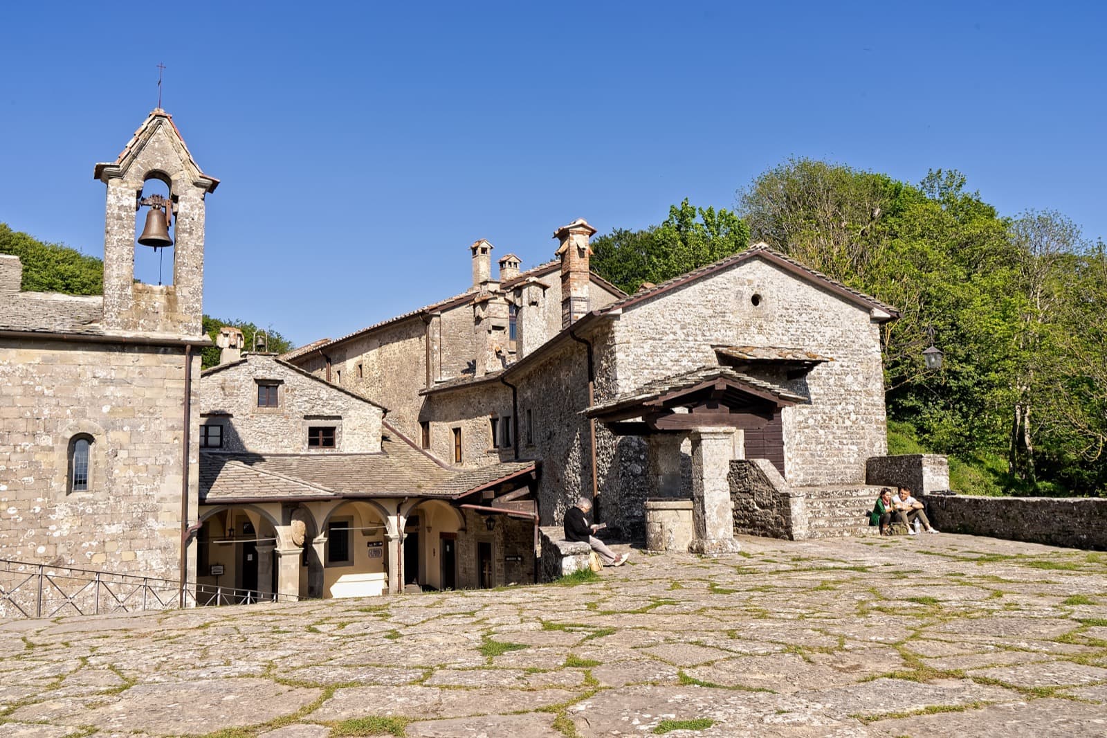
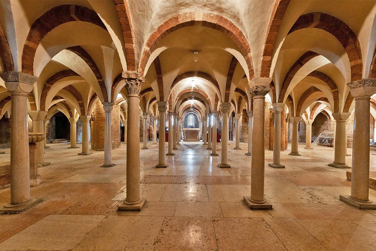
This short circular route starts from the town of Chiusi (already in the Tuscan territory) and follows the traces of entire generations of pilgrims who walked up the mountain, following the trail of San Francesco, to the Sanctuary of La Verna.
Walking along the ancient mule tracks surrounded by the enchantment of the forest, you reach one the most beautiful cliffs you can imagine: trapezoidal-shaped rocky cliff, Mount della Verna is first of all a sacred place, inextricably linked to the memory of St. Francis, but it’s also an important historical-artistic-cultural center, which certainly deserves a visit also for the panorama that can be enjoyed from its summit.
If you want, from La Beccia it’s possible to take another path: a ring path around Mount Santo in one of the most beautiful woods in Italy. The tour is complementary to the previous one and both are consequential to the visit to the Sanctuary.
Discover the St. Francis Waly from Rimini to La Verna
On the top of the Apennines
Difficulty: 4 out of 5 boots
Total length: 16.2 km
Difference in altitude: 1000 m
Average walking time: 6,15 hours
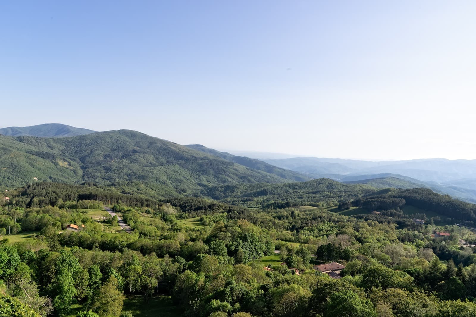
This scenic high altitude itinerary, which includes the outward journey through the “Gorga Nera” and the return via the Lupo slope, touches the major peaks of the Tosco-Romagnolo Apennine: Monte Falterona and Monte Falco.
It’s also possible to start from the Fonte del Borbotto, walking “just” on the summit ring (about 4 hours).
With departure and return from Castagno d’Andrea, on the other hand, you add 2 and a quarter hours, but with great enrichment of the landscapes and naturalistic aspect.
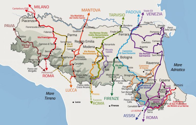
These are just some examples of paths to follow, but the Casentinesi Forest Park, with its network of over 600 km of paths, offers endless hiking possibilities, different in length, degree of difficulty and natural environments crossed.
All you have to do is consult the website trekking.parcoforestecasentinesi.it and the web map maps.parcoforestecasentinesi.it
Author

Elisa Mazzini
Social Media Manager for @inEmiliaRomagna and full-time mom.
You may also like
Route Planner: sloways in Emilia Romagna
by Walter Manni /// March 6, 2018
The Casentinesi forests, Monte Falterona and Campigna National Park
by Walter Manni /// March 26, 2018
The Natural Protected Areas of Emilia Romagna
by Elisa Mazzini /// July 13, 2020

Interested in our newsletter?
Every first of the month, an email (in Italian) with selected contents and upcoming events.
Hiking and Cycling Dante’s Way
by Margherita e Nick The Crowded Planet /// November 23, 2020
Route Planner: sloways in Emilia Romagna
by Walter Manni /// March 6, 2018
The Casentinesi forests, Monte Falterona and Campigna National Park
by Walter Manni /// March 26, 2018
The Natural Protected Areas of Emilia Romagna
by Elisa Mazzini /// July 13, 2020
Hiking and Cycling Dante’s Way
by Margherita e Nick The Crowded Planet /// November 23, 2020